


Bridgewater township voting district 11, Somerset County, New Jersey
About
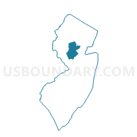
Outline

Summary
| Unique Area Identifier | 621975 |
| Name | Bridgewater township voting district 11 |
| County | Somerset County |
| State | New Jersey |
| Area (square miles) | 2.10 |
| Land Area (square miles) | 2.09 |
| Water Area (square miles) | 0.00 |
| % of Land Area | 99.89 |
| % of Water Area | 0.11 |
| Latitude of the Internal Point | 40.58843590 |
| Longtitude of the Internal Point | -74.63451860 |
Maps


Graphs
Select a template below for downloading or customizing gragh for Bridgewater township voting district 11, Somerset County, New Jersey


Neighbors
Neighoring Voting District (by Name) Neighboring Voting District on the Map
- Bridgewater township voting district 18, Somerset County, NJ
- Bridgewater township voting district 21, Somerset County, NJ
- Bridgewater township voting district 29, Somerset County, NJ
- Bridgewater township voting district 30, Somerset County, NJ
- Bridgewater township voting district 32, Somerset County, NJ
- Bridgewater township voting district 35, Somerset County, NJ
- Bridgewater township voting district 36, Somerset County, NJ
- Bridgewater township voting district 4, Somerset County, NJ
- Bridgewater township voting district 5, Somerset County, NJ
- Raritan borough voting district 4, Somerset County, NJ
- Raritan borough voting district 5, Somerset County, NJ
- Somerville borough voting district 1, Somerset County, NJ
- Somerville borough voting district 10, Somerset County, NJ
- Somerville borough voting district 2, Somerset County, NJ
- Somerville borough voting district 3, Somerset County, NJ
Top 10 Neighboring County Subdivision (by Population) Neighboring County Subdivision on the Map
- Bridgewater township, Somerset County, NJ (44,464)
- Somerville borough, Somerset County, NJ (12,098)
- Raritan borough, Somerset County, NJ (6,881)
Top 10 Neighboring Place (by Population) Neighboring Place on the Map
- Bradley Gardens CDP, NJ (14,206)
- Somerville borough, NJ (12,098)
- Raritan borough, NJ (6,881)
- Green Knoll CDP, NJ (6,200)
Top 10 Neighboring Unified School District (by Population) Neighboring Unified School District on the Map
- Bridgewater-Raritan Regional School District, NJ (51,345)
- Somerville Borough School District, NJ (12,098)
Top 10 Neighboring State Legislative District Lower Chamber (by Population) Neighboring State Legislative District Lower Chamber on the Map
Top 10 Neighboring State Legislative District Upper Chamber (by Population) Neighboring State Legislative District Upper Chamber on the Map
Top 10 Neighboring 111th Congressional District (by Population) Neighboring 111th Congressional District on the Map
Top 10 Neighboring Census Tract (by Population) Neighboring Census Tract on the Map
- Census Tract 507.03, Somerset County, NJ (4,950)
- Census Tract 508.02, Somerset County, NJ (4,406)
- Census Tract 508.01, Somerset County, NJ (3,841)
- Census Tract 506, Somerset County, NJ (3,677)
- Census Tract 509.02, Somerset County, NJ (3,677)
- Census Tract 505, Somerset County, NJ (3,204)
- Census Tract 501, Somerset County, NJ (3,055)
- Census Tract 502, Somerset County, NJ (2,832)